As expected Dorian is now moving northwest at 2mph. The first watches have been discontinued:
- TS watch south of Deerfield beach
- hurricane watch south of Jupiter, the TS warning still stays in effect
All other watches and warnings remain and some have been extended into GA, SC and NC.
The forecast track remains the same and the NHC has kept this forecast track to the west of the consensus of the forecast models.
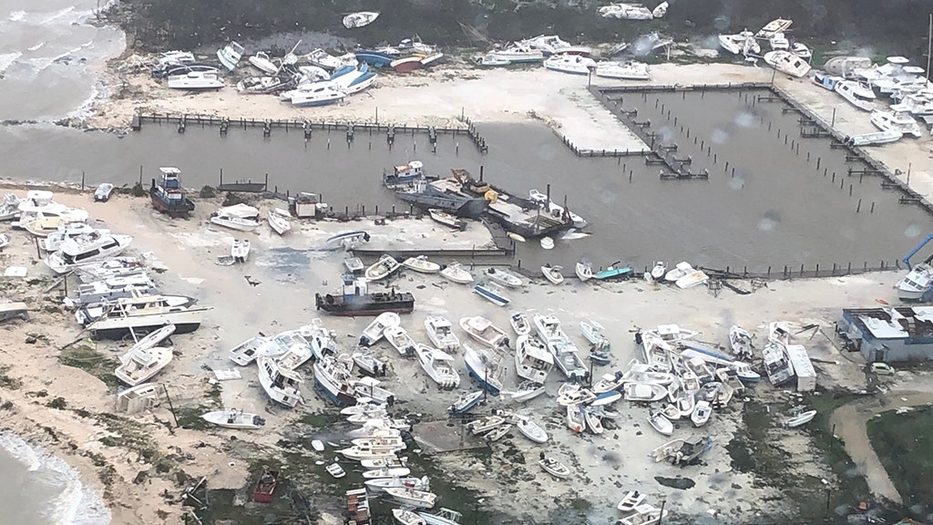
Like with every weakening hurricane the windfields are expected to expand. Dorian has now top sustained winds of 110mph.
SUMMARY OF WATCHES AND WARNINGS IN EFFECT:
A Storm Surge Warning is in effect for...
* Jupiter Inlet FL to South Santee River SC
A Storm Surge Watch is in effect for...
* North of South Santee River SC to Cape Lookout NC
A Hurricane Warning is in effect for...
* Grand Bahama and the Abacos Islands in the northwestern Bahamas
* Jupiter Inlet FL to Ponte Vedra Beach FL
* North of Edisto Beach SC to South Santee River SC
A Hurricane Watch is in effect for...
* North of Ponte Vedra Beach FL to Edisto Beach SC
* North of South Santee River SC to Duck NC
* Albemarle and Pamlico Sounds
A Tropical Storm Warning is in effect for...
* North of Deerfield Beach FL to Jupiter Inlet FL
* North of Ponte Vedra Beach FL to Edisto Beach SC
A Tropical Storm Watch is in effect for...
* Lake Okeechobee
https://www.nhc.noaa.gov/text/refresh/MIATCPAT5+shtml/031450.shtml?
https://www.nhc.noaa.gov/text/refresh/MIATCDAT5+shtml/031451.shtml?
https://www.nhc.noaa.gov/text/refresh/MIATCMAT5+shtml/031449.shtml?
.jpg")
Just for clarification: the outer circle are gale force winds (below TS strength), the middle circle are TS strength winds and the inner circle are Hurricane force winds.
.jpg")