Dorian and Hurricane Preperation | Page 17 | FinHeaven - Miami Dolphins Forums

Dorian and Hurricane Preperation

I’ve come to the conclusion that no one knows where it’s going not even the professionals. **** this storm.

It is exactly doing what it was forecasted to do (or not to do). Maybe Dorian is a warning shot for everybody and everybody should think twice about the sources if this is unexpected.
 
Ok, but isn’t there an image type where they can effectively erase the cloud cover to see the land underneath? Some sort of composite that utilizes infrared to “erase” the storm? If not, what kind of image is that?
It is called SAR (synthetic aperture radar). It "creates" images. There is a mega problem with that image. It does not differentiate between a regular flooding and an island "wiped" out. The Bahamas are very low lying and flat. I am not surprised about the flooding they experience in a Cat 5 hurricane especially one which hangs over them for a couple days with the NW and NE quadrants pushing the water onshore. Any land would have severe flooding like that.
 
It is called SAR (synthetic aperture radar). It "creates" images. There is a mega problem with that image. It does not differentiate between a regular flooding and an island "wiped" out. The Bahamas are very low lying and flat. I am not surprised about the flooding they experience in a Cat 5 hurricane especially one which hangs over them for a couple days with the NW and NE quadrants pushing the water onshore. Any land would have severe flooding like that.

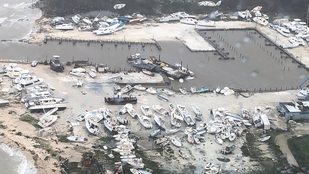
I don’t think anyone suggested the island was permanently flooded. Apologies if it came across like that. It was just a real-time image of the flooding, which is severe and shocking if accurate. Half the island is underwater. Obviously I expect the water to recede once the storm leaves.
 
I don’t think anyone suggested the island was permanently flooded. Apologies if it came across like that. It was just a real-time image of the flooding, which is severe and shocking if accurate. Half the island is underwater. Obviously I expect the water to recede once the storm leaves.
It was not so much you but rather the twitter's phere.
 
Last edited:
As expected Dorian is now moving northwest at 2mph. The first watches have been discontinued:
- TS watch south of Deerfield beach
- hurricane watch south of Jupiter, the TS warning still stays in effect

All other watches and warnings remain and some have been extended into GA, SC and NC.
The forecast track remains the same and the NHC has kept this forecast track to the west of the consensus of the forecast models.
Like with every weakening hurricane the windfields are expected to expand. Dorian has now top sustained winds of 110mph.

SUMMARY OF WATCHES AND WARNINGS IN EFFECT:

A Storm Surge Warning is in effect for...
* Jupiter Inlet FL to South Santee River SC

A Storm Surge Watch is in effect for...
* North of South Santee River SC to Cape Lookout NC

A Hurricane Warning is in effect for...
* Grand Bahama and the Abacos Islands in the northwestern Bahamas
* Jupiter Inlet FL to Ponte Vedra Beach FL
* North of Edisto Beach SC to South Santee River SC

A Hurricane Watch is in effect for...
* North of Ponte Vedra Beach FL to Edisto Beach SC
* North of South Santee River SC to Duck NC
* Albemarle and Pamlico Sounds

A Tropical Storm Warning is in effect for...
* North of Deerfield Beach FL to Jupiter Inlet FL
* North of Ponte Vedra Beach FL to Edisto Beach SC

A Tropical Storm Watch is in effect for...
* Lake Okeechobee

https://www.nhc.noaa.gov/text/refresh/MIATCPAT5+shtml/031450.shtml?
https://www.nhc.noaa.gov/text/refresh/MIATCDAT5+shtml/031451.shtml?
https://www.nhc.noaa.gov/text/refresh/MIATCMAT5+shtml/031449.shtml?


adv41_11am (1).jpg

Just for clarification: the outer circle are gale force winds (below TS strength), the middle circle are TS strength winds and the inner circle are Hurricane force winds.
adv41_11am (2).jpg
 
Im just curious when the winds will start. I assume the Melbourne area will see 50+ mph winds tonight. The only thing open here is home depot and lowes. Not much else
 
Im just curious when the winds will start. I assume the Melbourne area will see 50+ mph winds tonight. The only thing open here is home depot and lowes. Not much else
Based on the track forecast and the windfield I doubt it will go above 50+. Maybe a gust here and there but nothing sustained. You probably will have a lot of gale force winds which a lot of people misconstrue as TS storm winds.
 
Back
Top Bottom